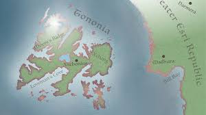
Lynda – Esri ArcGIS Maps for Creative Cloud Extension-APoLLo
English | Size: 168.37 MB
Category: Tutorial
Find out how to create vector-based, pixel-based, data-driven maps inside Illustrator and Photoshop using the ArcGIS Maps for Creative Cloud extension from Esri. Instructor Tony Harmer demonstrates how to acquire and install the extension, create an account, and open the extension from within the apps. He shows how to find and import a map, work with the layers, sync data, and change the style and appearance. Plus, Tony explains the limitations and capabilities of different options available for the extension.
Topics include:
Creating a map with ArcGIS
Understanding extents and scale
The Mapboards window
Synced layers in Illustrator and Photoshop
Building styles
Swapping default symbols
Optimizing data
Outlining the concept
Preparing data
DOWNLOAD:

